Log in
All resources
Create a design
41,226 Free Images of 1899 Maps
maps made in the 17th century
gerard valck
maps by pieter schenk (i)
atlantis magni tomus secundus (biblioteca comunale di trento)
atlantis magni tomus tertius (biblioteca comunale di trento)
fonds ancely - bibliothèque municipale de toulouse - maps
victor levasseur - maps of france
list of vanity fair (british magazine) caricatures (1895–1899)
maps in the library of congress
maps from the mechanical curator collection
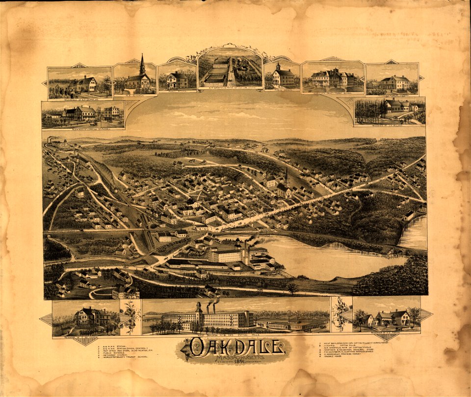
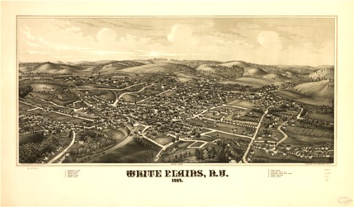
massachusetts
oakdale
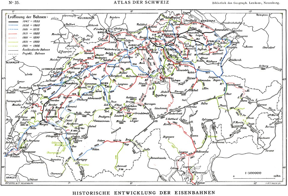
history of rail transport in switzerland
rail transport maps of switzerland
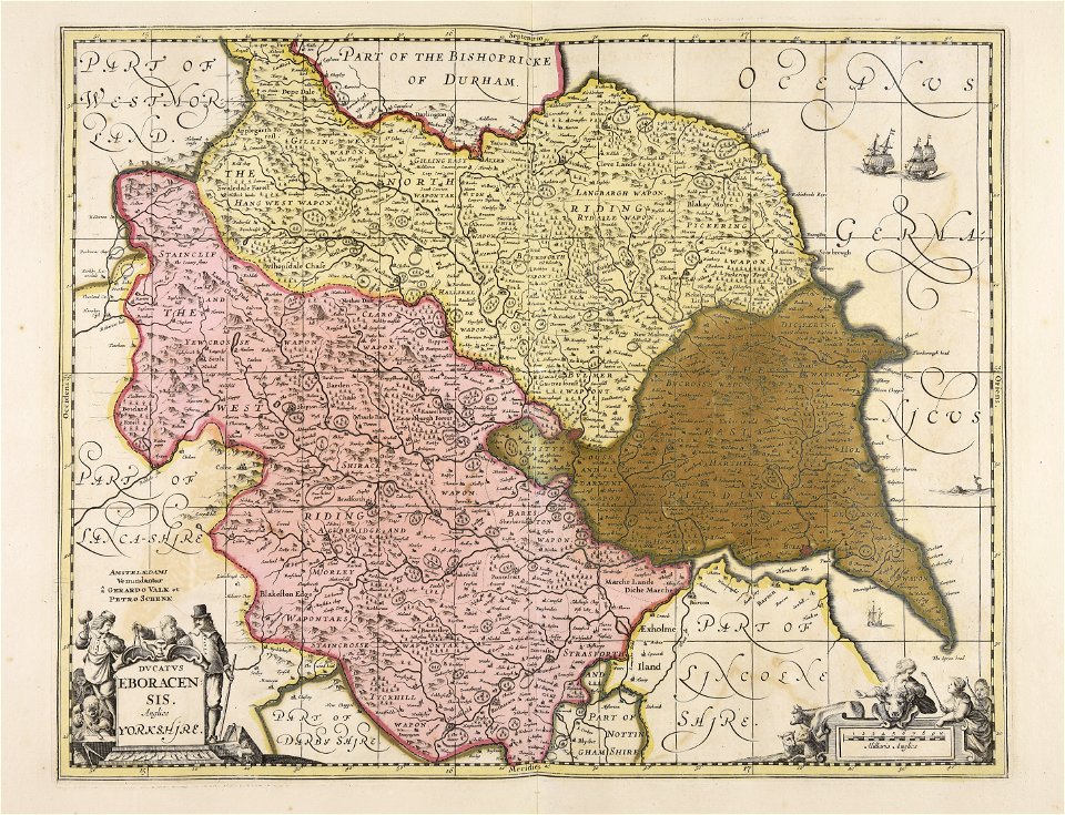
university of toronto wenceslas hollar digital collection
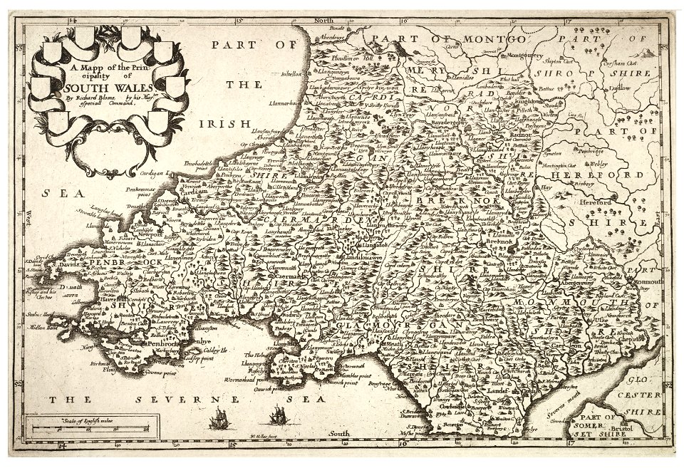
old maps of wales
maps by alexandre vuillemin
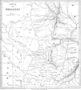
old maps of paraguay
ancient egypt
egypt
johann christoph winkler
old maps of prague
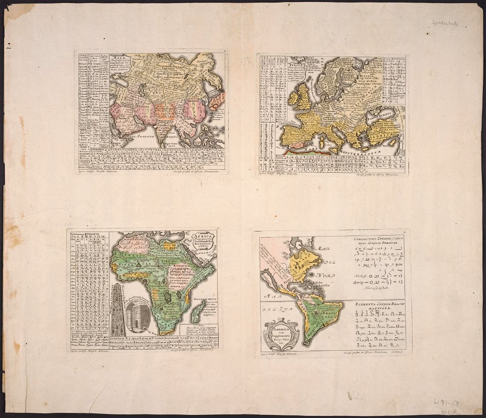
1590s maps of the world
frans hogenberg
maps in the library of congress
new york
claudio monteverdi
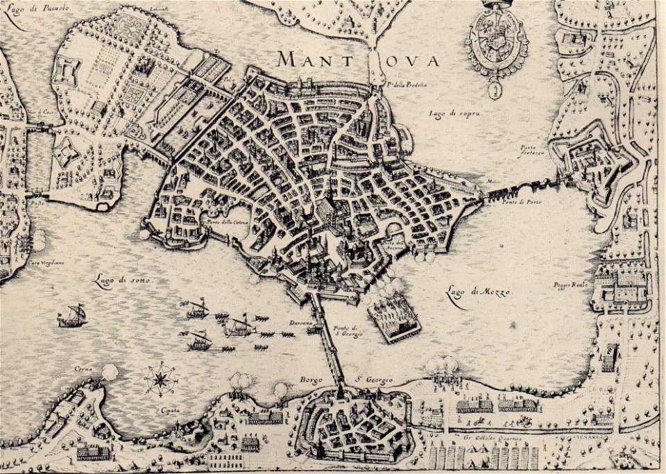
history of mantua
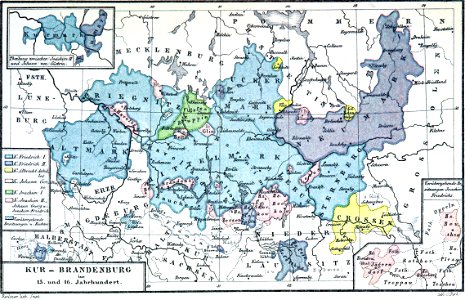
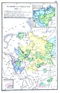
western pomerania
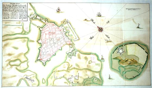
maps of stralsund
maps in the library of congress
l. r. burleigh
arnold's geographical handbook (1899)
global maps of climate zones
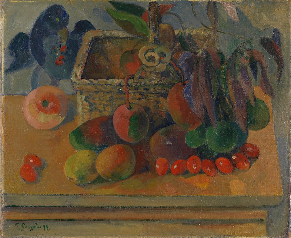
list of paintings by paul gauguin
arkitektur og design
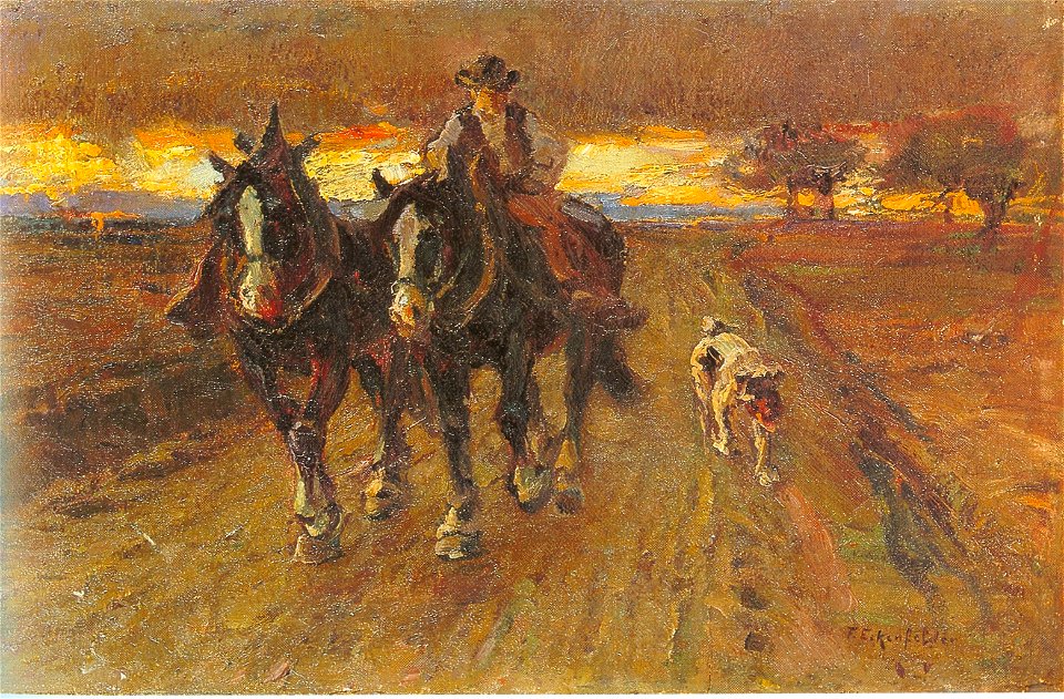
19th-century paintings of people with horses
19th-century paintings of people with dogs
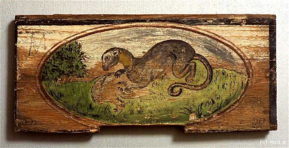
mustela putorius in art
radovljica
blanco y negro
1899
1890s paintings in private collections
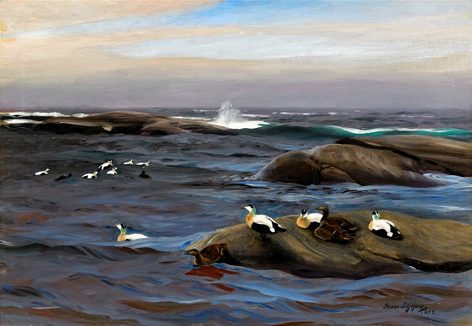
oil paintings of birds
images by archaeodontosaurus albi musée toulouse-lautrec
may 2021 in tarn
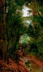
paintings by almeida júnior in the pinacoteca do estado de são paulo
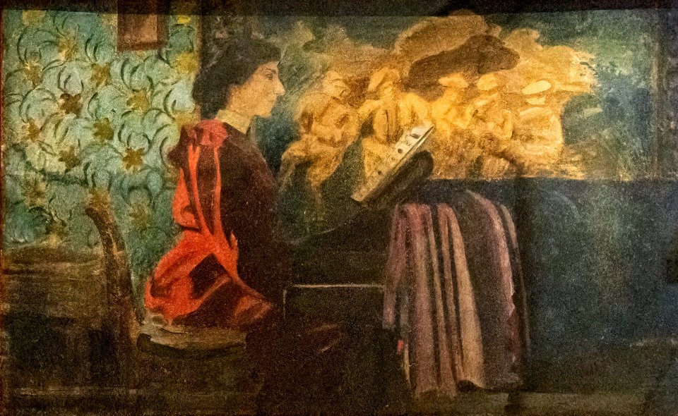
1899 oil on canvas paintings
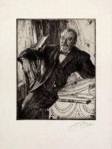
prints by anders zorn by delteil number
etchings of men
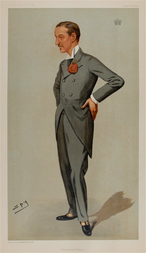
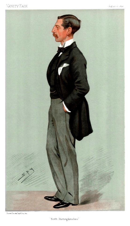
list of vanity fair (british magazine) caricatures (1895–1899)
oxford
caricatures by leslie ward in vanity fair
vanity fair caricatures (politicians)
list of vanity fair (british magazine) caricatures (1895–1899)
caricatures by leslie ward in vanity fair
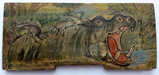
hippopotamus amphibius in art
radovljica
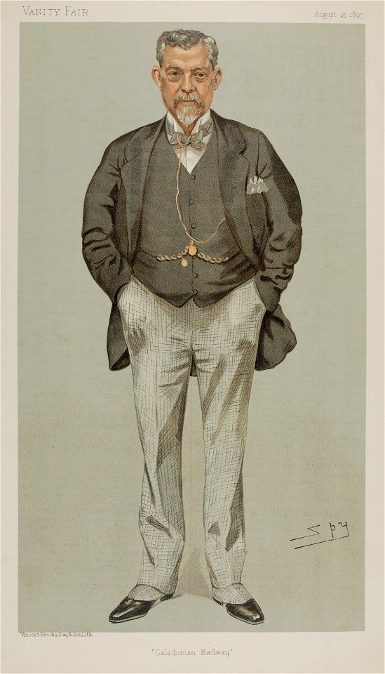
vanity fair
1898
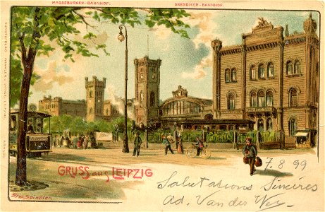
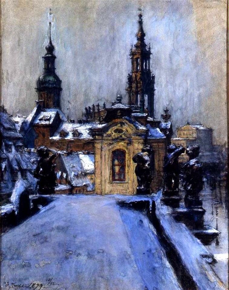
1899 in leipzig
leipzig
winter in cityscape paintings
paintings of dresden
vanity fair caricatures (politicians)
minister of agriculture
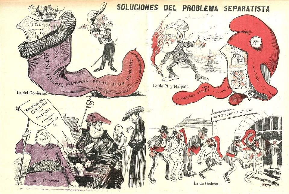
gedeón
1899
maps made in the 17th century
gerard valck
fonds ancely - bibliothèque municipale de toulouse - maps
maximilien sébastien foy
fonds ancely - bibliothèque municipale de toulouse - maps
coats of arms of rennes
fonds ancely - bibliothèque municipale de toulouse - maps
coats of arms of le mans
fonds ancely - bibliothèque municipale de toulouse - maps
pierre-jean david
fonds ancely - bibliothèque municipale de toulouse - maps
frédéric-auguste laguillermie
coats of arms of bordeaux
carle vernet
fonds ancely - bibliothèque municipale de toulouse - maps
frédéric-auguste laguillermie
coats of arms of strasbourg (i)
jean-baptiste kléber
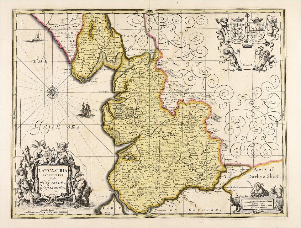
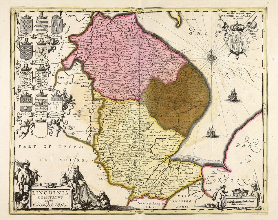
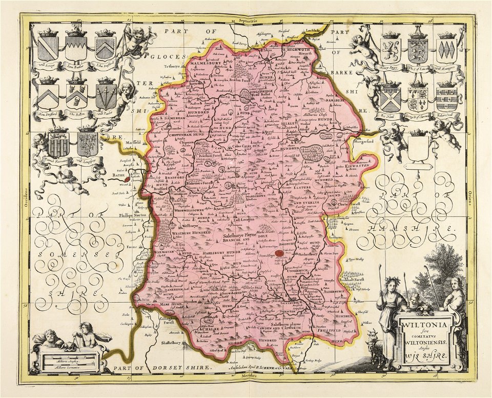
maps made in the 17th century
gerard valck
gerard valck
germany
lithographs of montana
montana
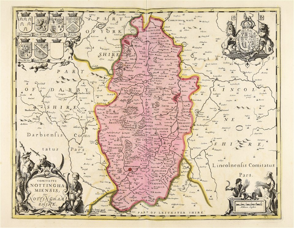
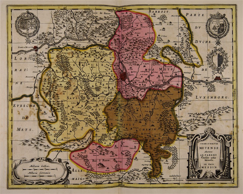
maps made in the 17th century
gerard valck
california gold rush
john sutter
maps made in the 17th century
gerard valck
maps of the dutch east india company - madagascar
1665
maps of the dutch east india company - indonesia
1705
maps made in the 17th century
gerard valck
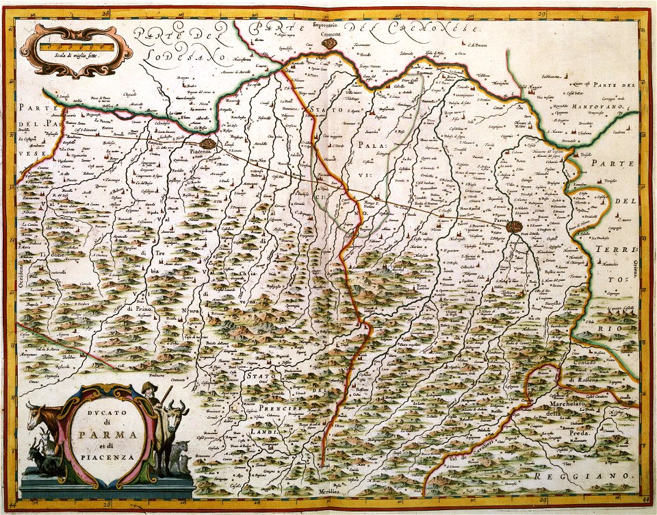
maps with cartouches
joan blaeu
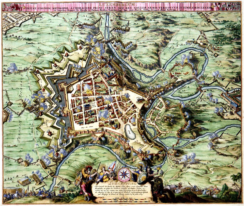
maps of luxembourg city walls
maps with cartouches
maps with cartouches
atlas van der hagen
old maps of the hague
siege of leiden
maps in musée de la compagnie des indes
17th-century engravings
maps made in the 17th century
gerard valck
maps made in the 17th century
gerard valck
cornell: persuasive cartography: the pj mode collection
cornell university library
maps made in the 17th century
gerard valck
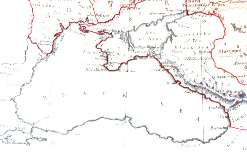
pictorial history of the russian war 1854-5-6 by george dodd
maps of circassia
maps made in the 17th century
lochaber
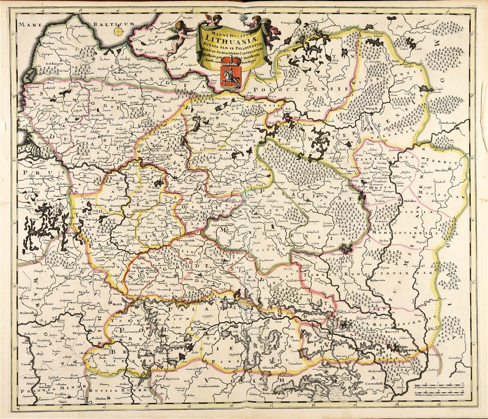
old maps of the grand duchy of lithuania
maps made in the 17th century
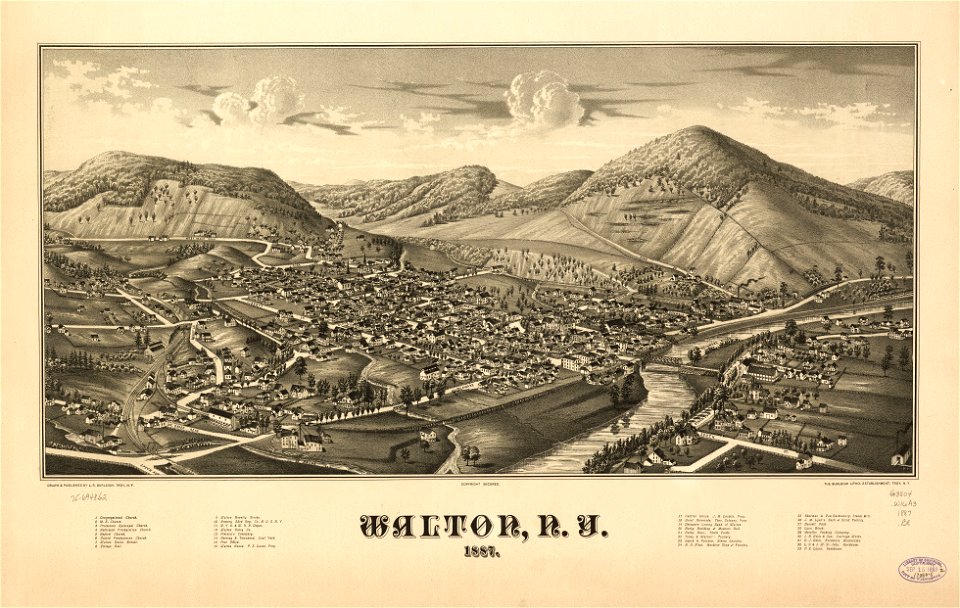
new york
walton
maps made in the 17th century
gerard valck
maps made in the 17th century
gerard valck
maps made in the 17th century
gerard valck
maps by pieter schenk (i)
gerard valck
maps made in the 17th century
gerard valck
maps made in the 17th century
gerard valck
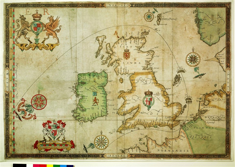
the track of the armada around britain and ireland
charts and maps of the royal museums greenwich
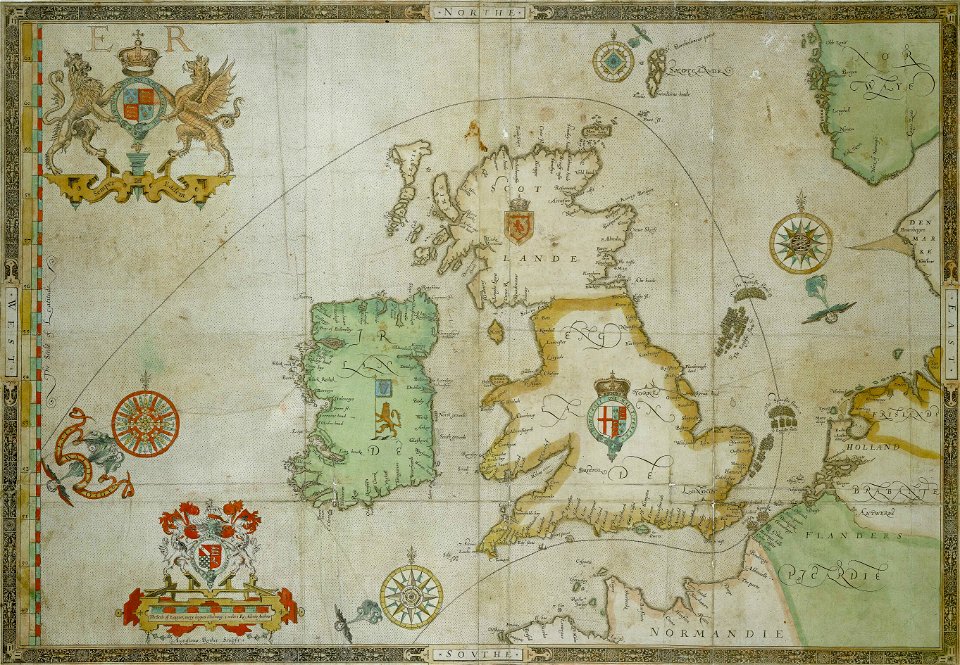
the track of the armada around britain and ireland
charts and maps of the royal museums greenwich
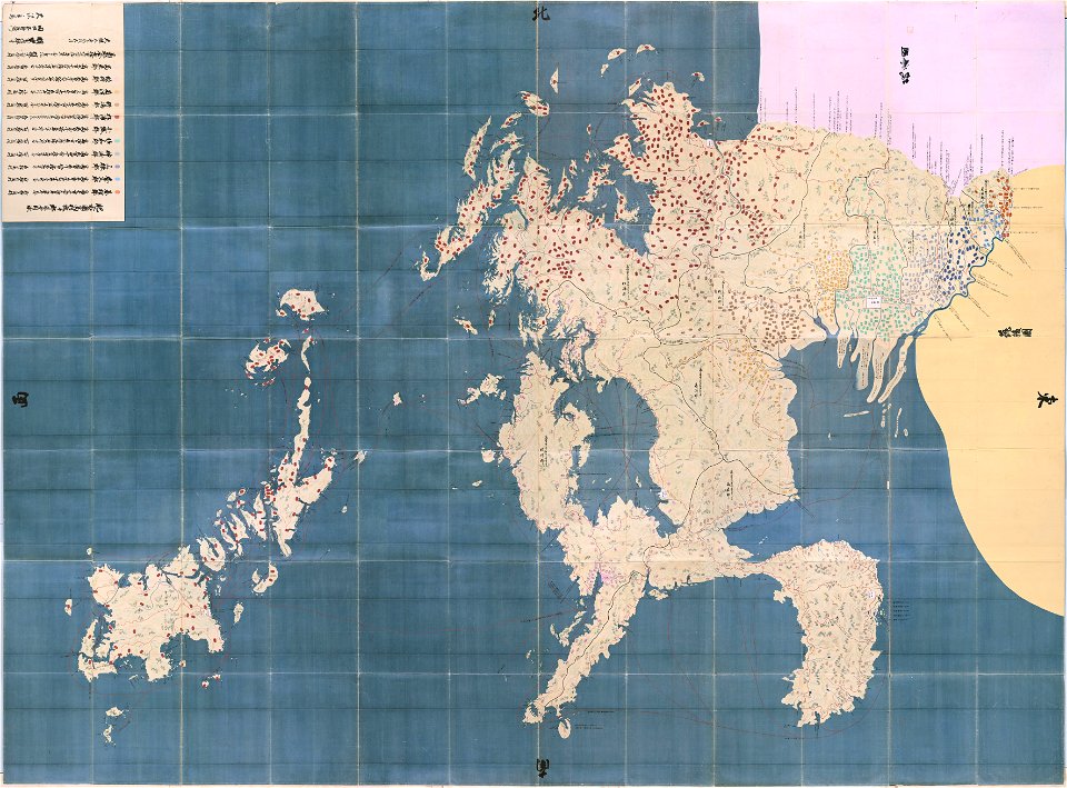
maps in the national archives of japan
hizen province
maps of the aleutian islands
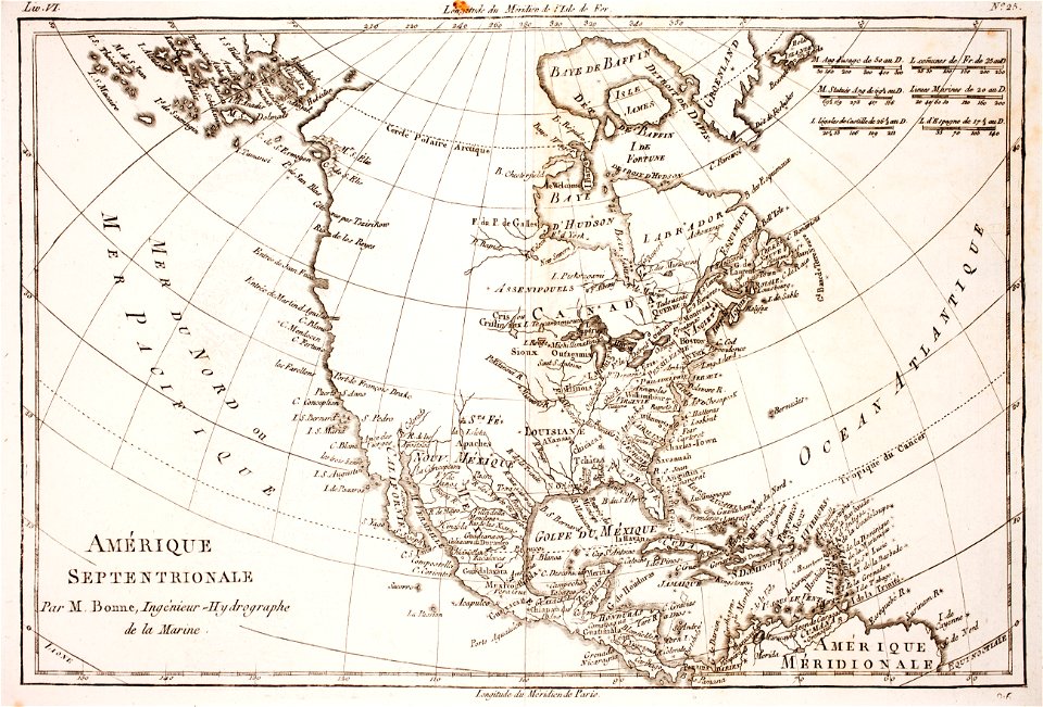
1780 maps of north america
maps made in the 17th century
gerard valck
maps made in the 17th century
gerard valck
maps made in the 17th century
gerard valck
olomouc fortress
1644
maps made in the 17th century
gerard valck
files from the bodleian libraries
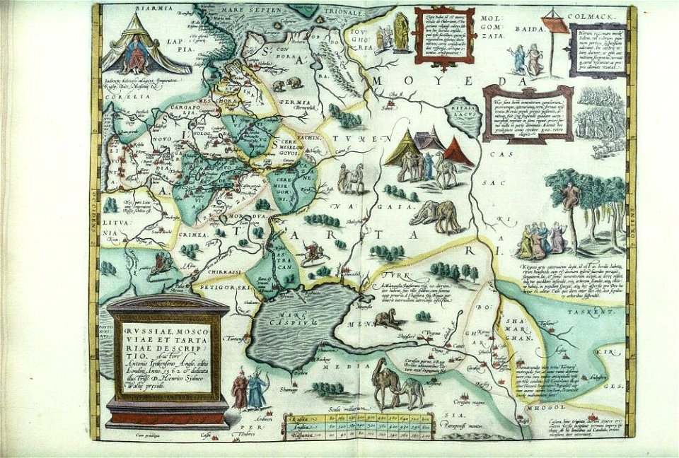
maps of tartary
maps made in the 17th century
gerard valck
maps made in the 17th century
gerard valck
maps made in the 17th century
gerard valck
maps made in the 17th century
gerard valck
maps made in the 17th century
gerard valck
parklandschaft klein-glienicke
königstraße (berlin-wannsee)
maps made in the 17th century
gerard valck
maps made in the 18th century
johann baptist homann
maps made in the 17th century
gerard valck
maps made in the 17th century
gerard valck
maps made in the 17th century
gerard valck
17th-century engravings
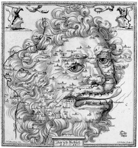
faces of men in art
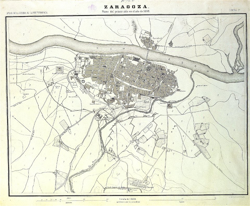
sitio de zaragoza (1808)
1868
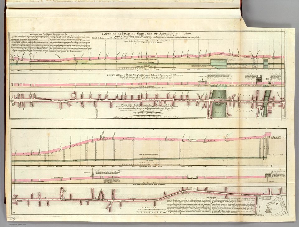
seine river in paris
old submaps of paris
maps from the mechanical curator collection
old maps of prussia
maps from the mechanical curator collection
old maps of prussia
old maps of the danube
french-language maps
physical geography (1899) by davis
19th-century maps of normandie
physical geography (1899) by davis
1899 maps of pennsylvania
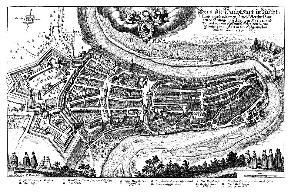
1638 in switzerland
bern
post-impressionism,japonisme,les nabis
1899 photographs of france
images from the new york public library
george hayward
maps from the mechanical curator collection
old maps of prussia
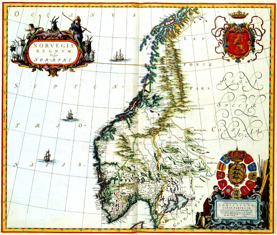
maps by willem and johannes blaeu
ravelins
7101 - 7200 of 41,226
Next page
/ 413